- Off The Beaten Trail!
- Posts
- California Dreaming, Part 2
California Dreaming, Part 2
...or, hiking in the High Sierra
Matt Reeder
July 31, 2025
Note: I was going to make this a super-long post but I ran out of time to finish it before we took off for the Goat Rocks. So I have decided to divide this post into two, because it was that great of a vacation. You can read Part One in my previous post.
After our first long weekend in June Lake with Wendy’s parents, we said goodbye to them and headed back to Mammoth for four days of camping just outside of town. Our campground was at 9,100 feet, an absolutely ludicrous elevation at which to camp for us. We could definitely notice the high elevation the first night. It took us a few days to adjust to the elevation.
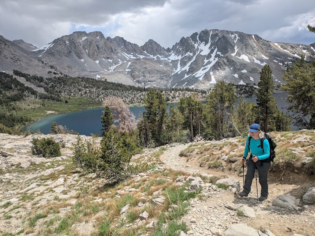
The first of our three big hikes was to the Saddlebag Lake area outside of the eastern side of Yosemite National Park. It was absolutely wild to start a hike at over 10,000 feet, and I definitely noticed the elevation on the first day. Thankfully, for such spectacular scenery, we did not have much elevation gain, only about 1,000 feet over 11.6 miles of hiking.
We started by hiking around Saddlebag Lake to its inlet, where we could see a waterfall tumbling down from the peaks above. Our goal for the hike was the Conness Lakes, a series of glacial lakes at the base of Mount Conness. The Conness Glacier is one of the largest glaciers left in the Sierra, and as we were following an unofficial trail on a weekday, I figured we’d have a decent chance at solitude as well as seeing some of the only turquoise glacial lakes in the Sierra. Using my GPS as well as common sense, we quickly located the user trail up to the lakes, which passes by this amazing waterfall:
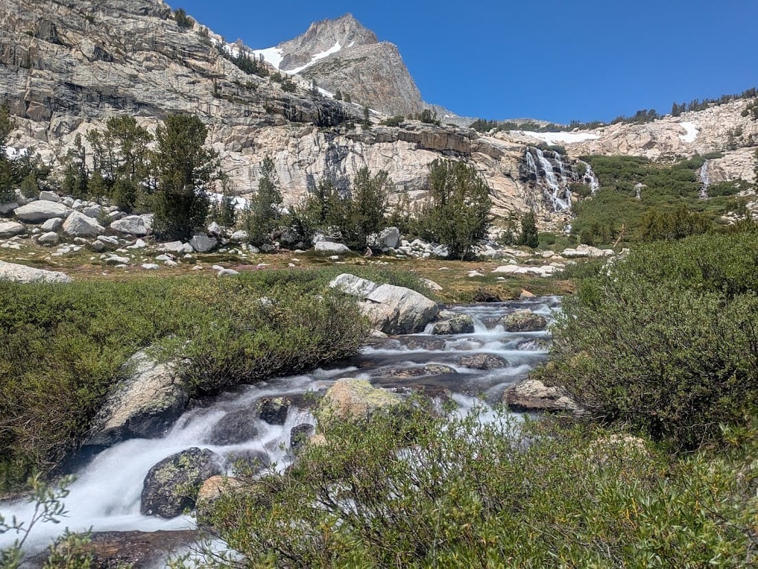
Conness Lakes Falls. The trail - actually there are two trails - pass by the right side of the falls.
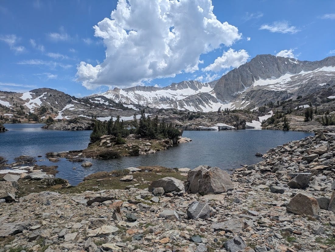
Once we made it into the Conness Lakes basin, everything was spectacular, one of the most beautiful places I’ve seen in recent years:

The first of the Conness Lakes.
The upper lakes are more turquoise, though not to the extent of the glacial lakes in Washington and points north. But still, hot damn:

The second of the Conness Lakes. We turned around here.
After visiting the Conness Lakes, we decided to go ahead and do the loop through the Twenty Lakes Basin here. Our first stop was Steelhead Lake, which was absolutely stunning:
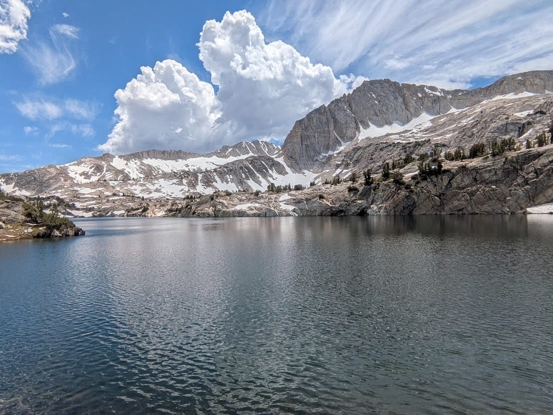
Steelhead Lake was absolutely stunning. Note the storm clouds brewing; it never built into a storm, thankfully.
Beyond Steelhead Lake, the trail got confused, meandering around several of the lakes in the basin. This is Shamrock Lake:
Shamrock Lake is presumably named after its shape, but it was a beautiful place.
Beyond Shamrock Lake, we hit several large patches of snow that forced us to turn around. It was frustrating, but it do be like that sometimes. This ended up being a long day, but deeply rewarding and extremely beautiful. There isn’t much info for this hike online. If you’re looking for a GPS track of my hike, here’s my track on Gaia.
The next day was our wedding anniversary, and what better way to celebrate than with another spectacular hike? This time our hike started directly from our campground, less than a quarter-mile from our campsite. We started out with an easy, gradual climb to Emerald Lake, where the reflection of the mountains was absolutely spectacular:
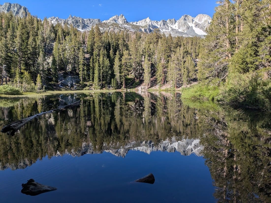
Emerald Lake in the early morning light.
Our trail then climbed uphill to a series of lakes, all of which were lovely. Did I mention that there are a lot of lakes in the Sierra Nevada? Well, there are. You’ll see lots more over the rest of this post.
As we climbed up towards Duck Pass, we passed quite a few gorgeous specimens of Sierra columbine (Aquilegia pubescens), a complete new flower to us. The only species of columbine that grows near us is the common Crimson columbine (Aquilegia formosa), so the Sierra columbine was new to us - and again, absolutely gorgeous:
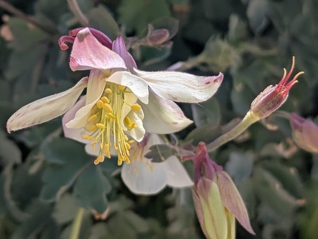
Sierra columbine on the Duck Pass Trail.
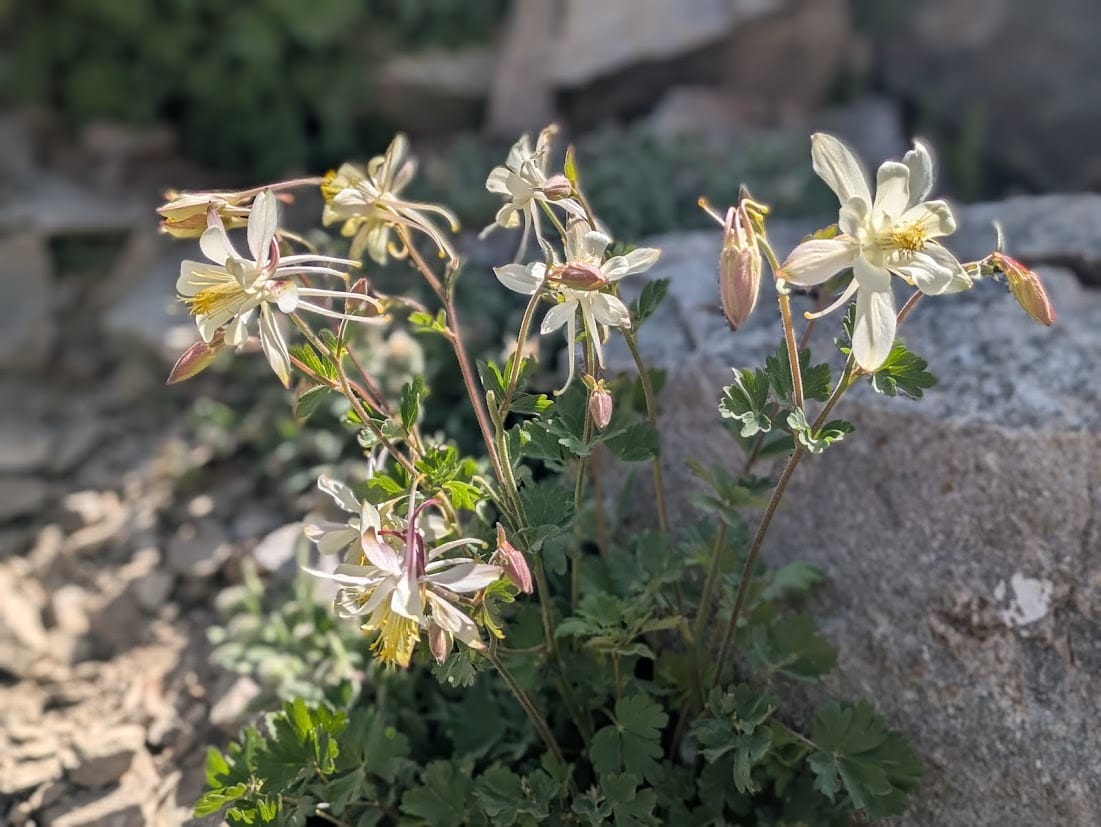
Sierra columbine on the Duck Pass Trail.
The Duck Pass Trail was absolutely spectacular, gaining elevation gradually as the views got better with every step:
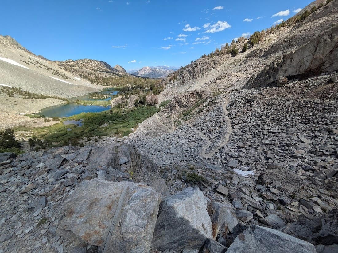
The Duck Pass Trail, with Barney Lake below.
We also saw quite a few pikas in the rockslide, though I was not able to photograph any of them clearly. One interesting difference: the pikas down here do not “MEEEEEP” like the pikas in the Pacific Northwest, or at least we never heard a meep. When we reached Duck Pass at 10,771 feet - or almost exactly the same elevation as the summit of Koma Kulshan (Mount Baker) - it was the highest elevation I had ever hiked. Just below the pass, we turned onto a side trail signed for Pika Lake. How could we not?

The turnoff for Pika Lake, just below Duck Pass.
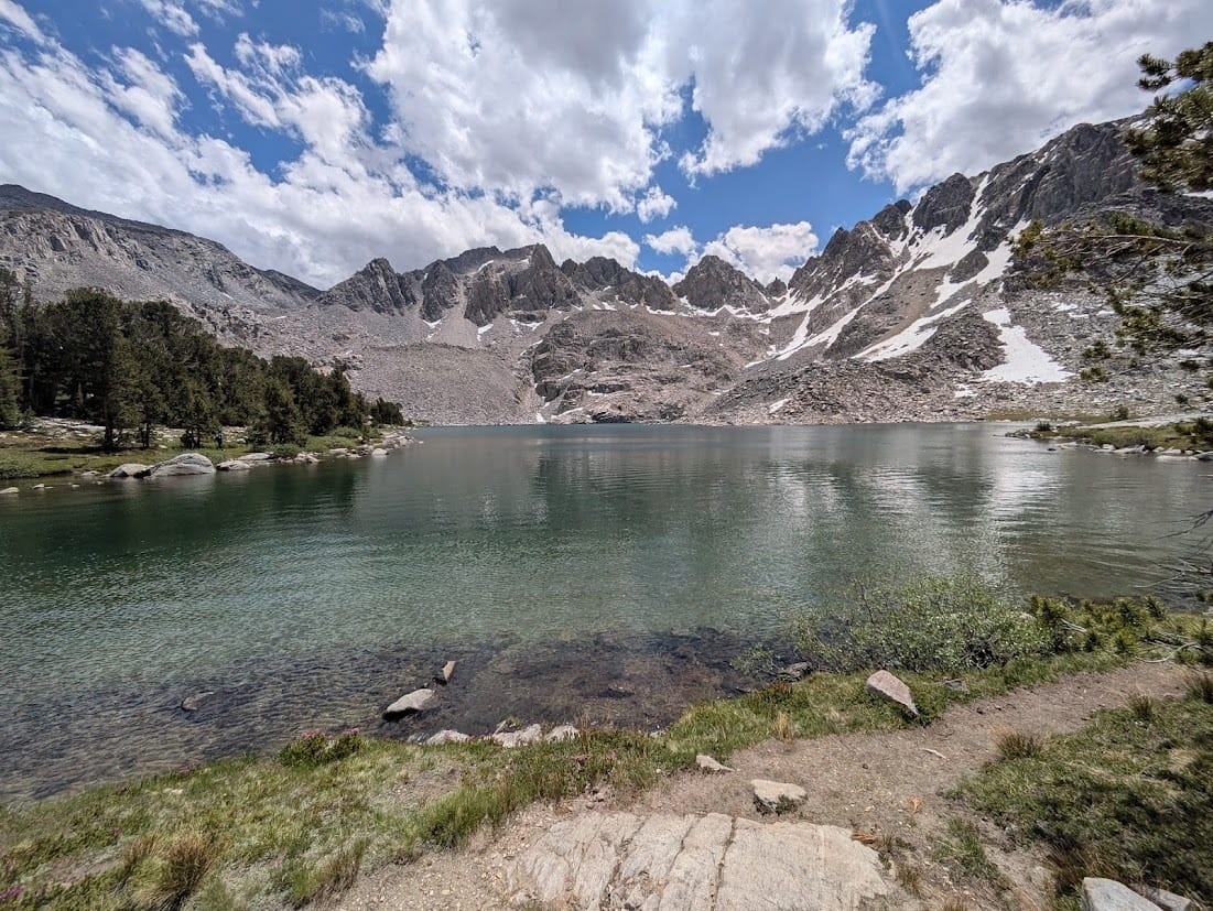
We passed views of Duck Lake on the way down:

Duck Lake
Duck Lake seemed to be the popular destination for this hike, so we mostly left the crowds behind as we traversed over to Pika Lake.
We reached Pika Lake at around noon and stopped for a light lunch. The lake was SPECTACULAR:

Pika Lake
Pika Lake, again
It was an extremely beautiful place, and we were entranced. We stopped for an anniversary selfie:

Fourteen years of marriage and we still like each other 😁
Clouds started building on our way back, and we could feel a storm coming on.
Hiking back uphill from Duck and Pika Lakes, as a storm builds
It did rain on us for awhile, but thankfully the thunderstorm never materialized beyond a single clap of thunder. This hike was tougher than the day before but not all that tough, other than the high elevation. Here’s my track on Gaia if you need it. We went to Mammoth Brewing Co. for dinner, a nice way to end an excellent anniversary.
The next day was an exciting one, as we were finally going to visit nearby Devils Postpile. We had been wanting to visit Devils Postpile for ages, only to be turned away by logistics and timing. Most notably, the easiest way to visit the monument is to take the shuttle bus down to the trailhead, and the road is only open to private vehicles under limited exceptions. The whole thing is somewhat confusing; see the links for more information, or feel free to ask. Expect to wait in line for a bus, and you may need to stand in a very crowded bus. Also: the road down is narrow, steep, and has serious exposure. You’ll be happier in a shuttle bus than you will be driving your own vehicle. Trust me on this one.
We finally made it down to the valley bottom by about 9:30 AM and started on our hike to the Postpile and Rainbow Falls. I’d first heard about this hike a very long time ago, in a seminal book my parents owned called Off the Beaten Path. I’ve linked to a copy on eBay here, but you can find it almost anywhere - and even now, all this time later, I highly recommend it. It was surreal to finally see the Postpile in person, and it lives up to expectations:

Devils Postpile

Another look at Devils Postpile
To be honest though, the trail does not give the best perspective of the Postpile, and the area is quite crowded. It was still very neat to see. More on this in a bit.
We continued our hike downstream towards Rainbow Falls, which we reached in about another hour. Along the way, we passed some huge Jeffrey pines, which are always delightful. Make sure you stop and smell the bark: it smells like butterscotch!

Smelling a Jeffrey pine is a memorable experience
We then continued to Rainbow Falls. The falls, like the Postpile, was impressive but also very crowded. This was another place I’d always wanted to see, and it mostly lived up to expectations:

Rainbow Falls, Devils Postpile National Monument

Yours truly at Rainbow Falls
By this time it was getting hot, and we decided to turn around and start the hike back. On the way back up, I suggested getting off the beaten trail and onto a different beaten trail, the PCT, which parallels the route to Rainbow Falls. We would make a loop on the PCT and then continue to Minaret Falls, another spectacular waterfall.
The PCT quickly drops to a bridge over the Middle Fork San Joaquin River. I took a photo at the bridge of this beautiful stream:

The Middle Fork San Joaquin River from the PCT bridge north of Rainbow Falls.
The PCT quickly climbs above the river, passing through this neat little slot canyon:

A neat little slot on the PCT in the Devils Postpile area.
The trail climbs well above the river, eventually passing excellent views across the canyon to the Postpile. For me, this is the best view of this amazing volcanic feature:

Devils Postpile from a vantage point across the canyon.
From here, we continued wandering up the canyon until we reached Minaret Falls. It was here that we finally saw our first Tiger lily (Lilium columbianum) of the trip:

Tiger lily (Lilium columbianum) near Minaret Falls and Devils Postpile.
Apparently the tiger lily is quite rare this far south so I guess this could be a different species of lily, but I’ve seen a lot of tiger lilies in my day (including on a hike we did in July that I’ll write about in my next post, whenever that is) and I’d be shocked if this was a different species.
Anyway, Minaret Falls exceeded expectations. I could see the falls from the Minaret Viewpoint that we visited the previous weekend and it looked quite impressive from afar. It was just as impressive up close:

I loved visiting Minaret Falls!
It was a wonderful day and I am grateful that we finally made it to Devil’s Postpile, even with the logistical issues. If you visit, I highly recommend following the loop I did, with the side trip along the PCT to the viewpoint of the Postpile and on to Minaret Falls. The overall hike was 7.6 miles round-trip with 727 feet of elevation gain. You can find my track on Gaia at this link.
From there, we drove up to Lee Vining to stay at a motel just off US 395. We had dinner at the Basin Cafe, which was excellent. The next morning, we stopped for a DELICIOUS breakfast at Latte Da in Lee Vining. If you’re in the area, both of these places are well worth a stop. We ended the hiking portion of our trip to the always spectacular Mono Lake, which was looking as beautiful as ever:

Long live Mono Lake!
We saw several osprey while we were there, including one holding a fish in its talons while returning to its nest. There are no fish in Mono Lake, so this osprey flew to the mountains to find a fish in a freshwater stream, then carried it all the way back to its nest on a tufa tower in Mono Lake. How cool is that?
While we’re at it, you should take some time to learn about Mono Lake if you haven’t done so already. In a region with many special places, Mono Lake is among the most special. There’s a reason why we have a “Long Live Mono Lake” bumper sticker on our car.
So anyway, here’s one more photo of the lake:

Long live Mono Lake!
From Mono Lake, we drove north to Reno to find our hotel. We repacked our bags, then went out for dinner with a friend (hi, Lauren!). We flew home to Portland the next morning, the conclusion of a truly wonderful vacation.
With Wendy’s parents not able to travel much anymore, we plan on spending lots of time down in the Eastern Sierra. I’m falling in love with it more every time I visit, and I cannot wait to explore it more. If you’re planning on visiting, please let me know! I’ll be glad to give you some tips.
As always, thanks for reading! I’ll be back soon with another post about all the hiking I did in July: this trip was just the beginning.
Cheers,
Matt